If weekends for you mean bikes on a shaded trail, a picnic by the water, or a quick playground stop between errands, you’ll feel at home in Sacramento. The American River Parkway threads through the city with easy access to neighborhood parks, nature programs, and miles of path for everyday exercise. Living near these green spaces can support your lifestyle and, according to national research, often aligns with stronger home demand for nearby properties. This guide shows you where to go, what to do, and how to plan smart visits along the river and in the city’s most-loved parks. Let’s dive in.
American River Parkway: quick snapshot
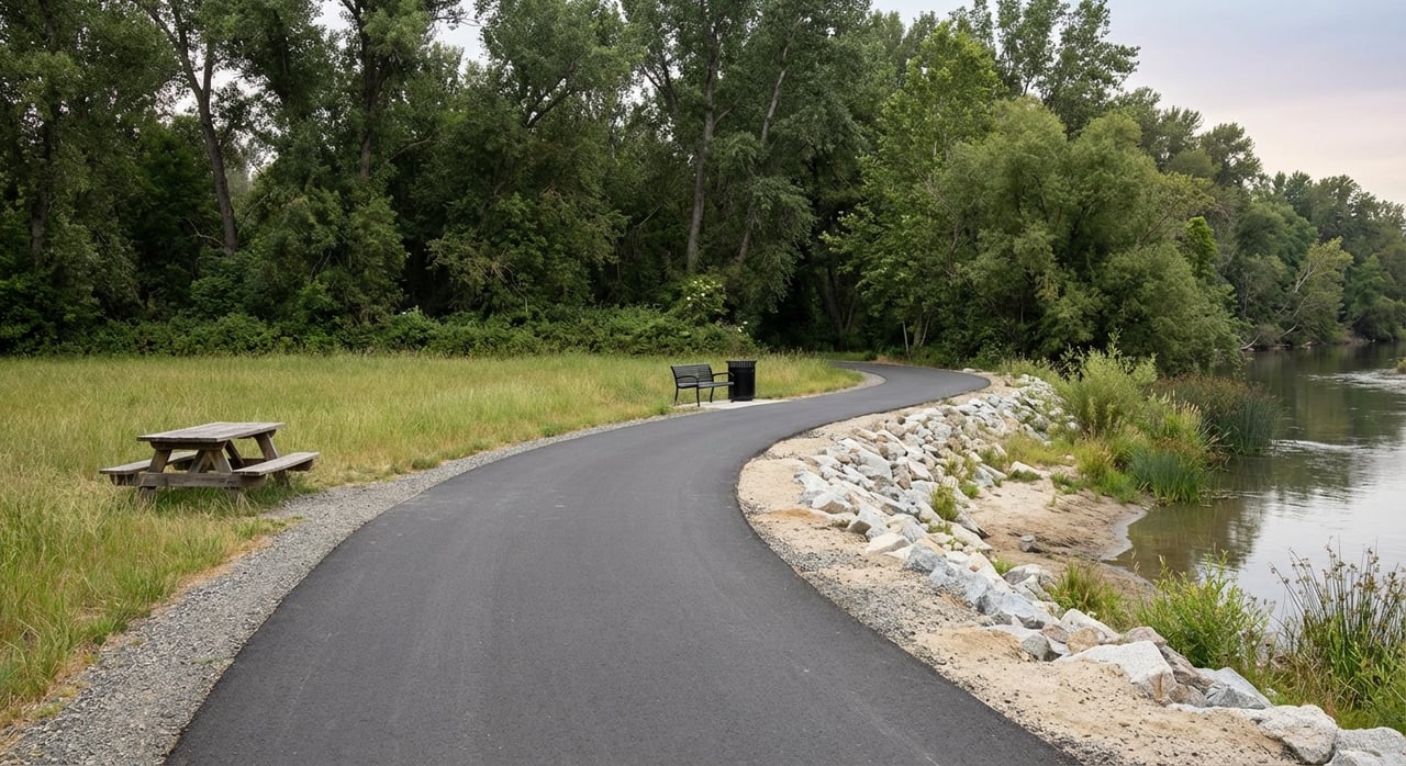
The American River Parkway is Sacramento’s signature open-space corridor. Its paved multi‑use route, the Jedediah Smith Memorial Trail, spans about 32 miles from Old Sacramento’s Discovery Park to Beal’s Point near Folsom Lake. You’ll find posted etiquette and a 15 mph guideline on much of the trail, and it’s popular for both long rides and daily commutes. Review route details and access points on the county’s Jedediah Smith trail page.
- Trail details and rules: See the county’s overview on the Jedediah Smith Memorial Trail.
- Parkway map and access: The American River Parkway Foundation shares helpful visit guidance and maps.
- Hours and vehicle fees: Most Parkway areas follow sunrise to sunset hours. Many access points collect vehicle parking fees, and the county offers an Annual Parks Pass that can save money if you visit often.
- Water safety: Sacramento County monitors E. coli and posts advisories for common access spots. Always check the Safe to Swim page, especially after storms.
Signature river parks
Discovery Park
At the confluence of the American and Sacramento Rivers, 302‑acre Discovery Park serves as the western trailhead for the Parkway. You get a boat ramp, car‑top launches, fishing access, picnic areas, and space for larger events. The park is designed to flood during very high water years, so confirm current conditions on the county site before planning water access. Explore amenities and updates on the Discovery Park page.
Sutter’s Landing Regional Park
Sutter’s Landing is a City of Sacramento riverfront spot that connects Midtown and the Central City to the Parkway. It features paved paths, a covered skate area, bocce and basketball courts, picnic spaces, and a sizable fenced off‑leash dog area. It’s a practical entry if you live near the grid and want quick river access for a walk or ride. See features on the Sutter’s Landing Regional Park page.
Ancil Hoffman Park
In the Carmichael area, Ancil Hoffman offers shaded oak trails, river access, and an 18‑hole public golf course. It is also home to the Effie Yeaw Nature Center, known for environmental education programs, wildlife viewing, and interpretive trails. Check dog leash rules and posted guidance before your visit. Learn more on the county’s Ancil Hoffman Park page.
River Bend Park and nearby access
River Bend Park is a well‑known launch and take‑out area for raft trips, with hiking and equestrian routes in the corridor. Across the Harold Richey bicycle bridge sits William B. Pond Recreation Area, which is popular for easy walks and fishing. Find regional details on the River Bend Park page.
City parks to know
William Land Park
This large urban park anchors weekend outings with the Sacramento Zoo, Fairytale Town, athletic fields, and picnic areas. It’s a go‑to for play dates and community events in the Land Park neighborhood.
McKinley Park
Near East Sacramento, McKinley Park attracts daily walkers with a tree‑lined loop, tennis courts, a playground, and a well‑known rose garden. It’s a classic neighborhood green space with a community feel.
Southside Park
Just south of downtown, Southside Park offers a pond, amphitheater, athletic courts, and a modern inclusive playground. It often hosts festivals and community gatherings.
Capitol Park
Surrounding the State Capitol, Capitol Park is a 40‑acre arboretum with memorial gardens, monuments, and the World Peace Rose Garden. It’s a botanical centerpiece within walking distance of downtown and Midtown.
Pick your activity
Cycle, run, commute
If you ride or run, the Jedediah Smith Memorial Trail is your backbone route. Plan your mileage using its painted markers, anticipate heavier use on weekends, and follow posted etiquette to keep traffic flowing. Review guidance and access points on the trail overview before a new route.
Boat, raft, paddle
For urban access, Discovery Park is a primary launch for small boats and car‑top craft, and River Bend Park is a common take‑out for raft trips. Always check flows, possible seasonal closures, and the county’s Safe to Swim page if you plan to wade or swim. Avoid contact with river water after storms per county guidance.
Fish and learn about wildlife
William B. Pond and nearby Parkway spots see regular angling, while the Effie Yeaw Nature Center provides programs and habitat viewing along the river. These are solid choices for weekend learning and low‑key outdoor time. Confirm park hours and fees before you go.
Dog walking and off‑leash options
In Sacramento County regional parks, dogs must be on leash unless you are in a designated off‑leash area. Several city parks offer fenced dog parks, including the large area at Sutter’s Landing. Review county rules and locations on the dog parks and leash policy page, and check the city page for Sutter’s Landing’s dog area details.
Playgrounds and festivals
For kids, William Land Park’s attractions and Southside Park’s inclusive playground make planning easy. Discovery Park often hosts large outdoor festivals, and neighborhood parks schedule seasonal events. If you are reserving group space, confirm permit requirements on the relevant park page.
Equestrian use
Equestrians stage and ride on unpaved routes within the Parkway, with restricted access to the paved multi‑use trail except at crossings. If you trailer in, plan around sunrise to sunset hours and confirm parking or staging areas via county park pages.
How parks shape your home search
Proximity to open space can influence home demand and pricing. A comprehensive U.S. review of studies found a positive relationship between nearness to parks or greenways and residential property values, though actual effects vary by park type and neighborhood context. You can read the summary of findings in this parks and property values review. Rather than focusing on a single number, use proximity, park type, and daily usefulness to gauge value.
Lifestyle benefits also matter. County messaging and national recreation surveys highlight how access to trails and nature supports regular activity and well‑being. If you plan to live near the river, consider how often you want to ride, run, or walk to a trailhead and which parks match your routines.
Here are a few location notes to help you match parks to neighborhoods:
- Land Park: Near William Land Park’s zoo, play spaces, and event lawns. Good for frequent park days without long drives.
- East Sacramento: Close to McKinley Park’s loop, rose garden, and courts for everyday walks.
- Midtown and Central City: Quick access to Sutter’s Landing for paved paths, a large dog area, and short rides to the Parkway.
- Arden‑Arcade and Carmichael: Near Ancil Hoffman Park and the Effie Yeaw Nature Center for shaded trails and nature programming.
To visualize distances and parking lots before a showing or weekend plan, explore the Parkway map and access guidance from the American River Parkway Foundation.
Practical tips before you go
- Hours and fees: Many Parkway sites operate sunrise to sunset, and several collect vehicle entrance fees. If you plan frequent visits, consider the county’s Annual Parks Pass.
- Safety and water quality: Check the county’s Safe to Swim advisories, especially after rain. Avoid water contact after storms and follow posted guidance at boat launches and beaches.
- Seasonal flows and flooding: Sites like Discovery Park are designed to flood during high water. Review the Park Status Update page for closures and maintenance notes before a river day.
Be a good steward
The Parkway thrives because of local care. If you want to get involved, the American River Parkway Foundation coordinates volunteer and stewardship programs across the corridor. The Effie Yeaw Nature Center also shares community programs that build appreciation for river habitats.
Ready to pair the right neighborhood with your favorite parks and trail access? Reach out to Melissa Lamberti for local guidance, smart search strategies, and a plan that fits your lifestyle.
FAQs
What is the American River Parkway and where does it run?
- It is a linear open‑space corridor along the American River with the paved Jedediah Smith Memorial Trail running about 32 miles from Discovery Park to Beal’s Point; see the county’s trail overview for details.
When are Parkway parks open and are there parking fees?
- Most sites are open sunrise to sunset, and many collect vehicle parking fees; frequent visitors can save with the county’s Annual Parks Pass.
Where can you launch a kayak or raft near downtown Sacramento?
- Discovery Park provides a major boat ramp and car‑top launch area that connects directly to the lower American River.
Is it safe to swim or wade in the American River with kids and dogs?
- Check the county’s Safe to Swim advisories before entering the water and avoid contact after storms, following posted guidance at access points.
Where can Midtown residents access the Parkway quickly?
- The Sutter’s Landing Regional Park entry offers paved paths, a dog park, and direct connection into the river corridor for walks and rides.
How do I check closures, restrooms, or maintenance updates before a visit?
- Review the county’s Park Status Update page for current conditions, closures, and operational changes.